
Scotland
Travelling, walks, places to visit
Based
on a journey across Scotland, 1.-14. September 1997,
devoted to all travelers hungry for any piece of
information
for their next trip.
 Our journey started in Prague, then
Calais, late evening ferry to Dover, and overnight ride
across England to Glasgow, upwards along Loch Lomond to
Bonave Furnace at Loch Etive.
Our journey started in Prague, then
Calais, late evening ferry to Dover, and overnight ride
across England to Glasgow, upwards along Loch Lomond to
Bonave Furnace at Loch Etive.
The morning sky was blue, air was fresh and crispy, the
overall weather was far from what we'd expected...
OBAN
is small, pleasant town, the very first one we visited in
Scotland. Unfortunately, our vigilance was quite low
after the overnight drive across whole England, so I have
only few notes: It is easy to find a place for car
parking along the steep streets above the harbor, which
is actually part of the town center. Don´t miss to
visit Coliseum-like wall above the town. It´s called
McCaig´s Tower. McCaig was wealthy banker at the end of
the 19th century and he let build this tower in 1897. Official reason was to generate jobs for Oban workers,
but the main one was probably to erect eternal monument
carrying his name. But as a matter of fact, the tower
offers the best views of the town and its surroundings
and it´s worth climbing the hill even if you are tired.
Right in the center, there is also one of the six Classic
Malts distilleries - Oban distillery. It is open to
public and, believe me, once you pass through three or
four distilleries, you´ll become an expert on whisky
production.
Official reason was to generate jobs for Oban workers,
but the main one was probably to erect eternal monument
carrying his name. But as a matter of fact, the tower
offers the best views of the town and its surroundings
and it´s worth climbing the hill even if you are tired.
Right in the center, there is also one of the six Classic
Malts distilleries - Oban distillery. It is open to
public and, believe me, once you pass through three or
four distilleries, you´ll become an expert on whisky
production.
The way up from Oban along Loch Linhe
is full of nice views with the panorama of Morvern
hills.
LOCH LEVEN
and surroundings
Leven is a narrow loch, hidden between steep Munros above
Glencoe and (also steep) hills of Mamore Forest.
We found pleasant spot for building tents at the rest
near the camp. Generally, places for tents are
everywhere. We usually built them not far from the road
and, since we used narrow, quiet ones, we were never
disturbed by any cars. Also water was not big issue.
There is plenty of water everywhere in Scotland and it is
clear and potable (well, clear also means brown peaty
color, but don't worry, local people drink it too).
Soon after building tents we encountered less pleasant
feature of Scottish land - midges. We had heard
about them before. Awful stories. But we had never
imagined how horrible they are. Unlike other
"normal" insects, midges are almost
invisible, you can´t hear them fly, and the only thing
you feel is their bites. And there are zillions of them
everywhere. Forget about repellents, they don´t work at
all. There are only three ways how to keep them at bay
1) Special hood made of tiny net
(they sell them in every drugstore)
2) Rapid walk. Midges don´t fly fast. Please don´t
stop!
3) Reasonable wind. To feel the wind on the face there is
like God´s blessing. You will understand what I´m
talking about.
Well, good start for selecting one of many possible walks
around the loch is to  visit Walking Center in Kinlochleven
- village at the end of Loch Leven. We decided
to climb on Mam na Gualainn, the hill 796m tall,
situated just above the northern bank of the loch. The simple map is here but you can
get a hardcopy and the description of the trip in the
Walking Center. Start there and follow the main road
leading through Kinlochleven to Fort Williams. Turn right
to the footpath behind the school yards (you'll pass the
school on the left hand). This path is known as West
Highland way and goes
visit Walking Center in Kinlochleven
- village at the end of Loch Leven. We decided
to climb on Mam na Gualainn, the hill 796m tall,
situated just above the northern bank of the loch. The simple map is here but you can
get a hardcopy and the description of the trip in the
Walking Center. Start there and follow the main road
leading through Kinlochleven to Fort Williams. Turn right
to the footpath behind the school yards (you'll pass the
school on the left hand). This path is known as West
Highland way and goes  from
Stirling to Fort Williams. From school it climbs up the
wooded hill and finally it merges with Old Military Road
(land rover track). Continue along the track for approx.
30min, you must pass two brooks, and then you'll find
narrow path turning left from the West Highland Way which
goes down towards the Allt Nathrach river. You'll cross
the river over the old partially broken bridge and then
climb the Beinn na Caillich along the zig-zag footpath.
If you go up all the time, you can't miss the top, there
is no other hill in sight. The same path goes on to
Mam na Gualainn. From the top
of both hills you could see the whole loch, hills above
Glencoe and to the north the highest Scottish mountain
Ben Nevis (1344m) and the hills around. The whole walk
was about 6 hours long with return.
from
Stirling to Fort Williams. From school it climbs up the
wooded hill and finally it merges with Old Military Road
(land rover track). Continue along the track for approx.
30min, you must pass two brooks, and then you'll find
narrow path turning left from the West Highland Way which
goes down towards the Allt Nathrach river. You'll cross
the river over the old partially broken bridge and then
climb the Beinn na Caillich along the zig-zag footpath.
If you go up all the time, you can't miss the top, there
is no other hill in sight. The same path goes on to
Mam na Gualainn. From the top
of both hills you could see the whole loch, hills above
Glencoe and to the north the highest Scottish mountain
Ben Nevis (1344m) and the hills around. The whole walk
was about 6 hours long with return.
LOCH NESS
Famous name, dark, terribly cold water, flat hills
around, not particularly stunning landscape. However,
swimming in the morning loch with the mist hovering above
water is kind of breathtaking (caused by both magical
place and icy water). We arrived to the loch in  the
evening and it welcomed us with beautiful sunset over its
dark waters.
the
evening and it welcomed us with beautiful sunset over its
dark waters.
We found Urquhart castle quite
interesting. It is very ancient ruins. Originally, it was
the fortress of old Picts, then the whole line of owners
and conquerors replaced each other and, eventually, the
castle was burned out and let alone in 18th century.
POINT OF
STOER
Here we are approaching Assynt, one of the
wildest and most remote  scenery in the United
Kingdom. Located in the far north west highlands of
Scotland the area is dominated by spectacular mountain
scenery. Isolated sandstone mountains rise up from an
undulating landscape of hummocks and lochs that is itself
formed of Lewisian Gneiss, one of the oldest rock types
in the world.
scenery in the United
Kingdom. Located in the far north west highlands of
Scotland the area is dominated by spectacular mountain
scenery. Isolated sandstone mountains rise up from an
undulating landscape of hummocks and lochs that is itself
formed of Lewisian Gneiss, one of the oldest rock types
in the world.
We left Inverness, passed Ullapool and  continued
along A894 road almost to Kylestrome. Before we'd
reached Loch Glencoul we turned left to B869 leading to
Drumbeg and west coast. We found suitable spot near
Drumbeg, just next to the road. We woke up into howling
wind, tents lying on us as if they had no sticks. Today
we wanted to take a walk
around Point of Stoer.
continued
along A894 road almost to Kylestrome. Before we'd
reached Loch Glencoul we turned left to B869 leading to
Drumbeg and west coast. We found suitable spot near
Drumbeg, just next to the road. We woke up into howling
wind, tents lying on us as if they had no sticks. Today
we wanted to take a walk
around Point of Stoer.
The starting point is the light house. Walking northwards
along the western coast of the cape, you´ll see an
interesting, tall, slim rock raising straight from the
sea - Old Man of Stoer.
The rock represents a challenge for most climbers thanks
to both water and strong winds. Take the walk around the
whole cape and return back to the light house over the
hilltop above the cape. The top is the magnificent
viewpoint, where you can see the whole panorama of
Assynt, and its dominants like Quinag, Ben More
Assynt, Canisp, Suillven, Cul Mor, Cul Beag and Stac
Pollaidh.
STAC
POLLAIDH
We hesitated between a walk to Suillven and to Stac
Pollaidh. The walk to Suillven was over 13 miles long and
we didn't manage to wake up early enough, 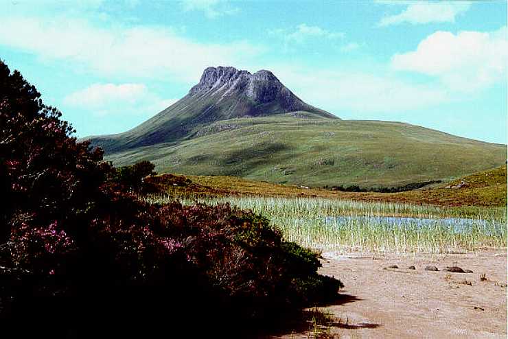 so we
chose to climb up to the rocky top of volcano like
mountain Stac Pollaidh. The path up starts at the car
park next to the road B869, few miles bellow
Inverkirkaig. There is only one way up and it is well
visible because this hill very popular. It takes approx.
one hour to get to the top. Walking across the top
requires little climbing technique but you don't have to
be freestyle boulderer to find some good places where you
can enjoy fantastic views of
most of Assynt.
so we
chose to climb up to the rocky top of volcano like
mountain Stac Pollaidh. The path up starts at the car
park next to the road B869, few miles bellow
Inverkirkaig. There is only one way up and it is well
visible because this hill very popular. It takes approx.
one hour to get to the top. Walking across the top
requires little climbing technique but you don't have to
be freestyle boulderer to find some good places where you
can enjoy fantastic views of
most of Assynt.
GLEN
TORRIDON
Glen Torridon is one of the most beautiful glens we met,
although we didn't make any trip there. But we slept
there overnight and I have to tell you. Imagine peaceful
valley with quiet small river where you can see real
eels, huge pines and our tents under them, no wind,
briefly fairy tale.
Remember midges? They found us. Not few of them,  zillions.
The fairy tale soon turned to comic horror. Why comic?
Our dinner may serve as example - imagine four people
with hoods over the head, gloves on hands (though it was
warm evening) walking fast in circles around the the pot
placed in the middle of the road, occasionally stopping
there to grab the mouthful and immediately moving on to
escape from attacking insects. Those few people, passing
along in the cars, even didn't hide their amusement. I
will better not describe the process of peeing in the
night. It was pure horror, not comedy.
zillions.
The fairy tale soon turned to comic horror. Why comic?
Our dinner may serve as example - imagine four people
with hoods over the head, gloves on hands (though it was
warm evening) walking fast in circles around the the pot
placed in the middle of the road, occasionally stopping
there to grab the mouthful and immediately moving on to
escape from attacking insects. Those few people, passing
along in the cars, even didn't hide their amusement. I
will better not describe the process of peeing in the
night. It was pure horror, not comedy.
SKYE
Before we got to Skye we dropped in Plockton,
picturesque village situated on the cape where you can
look across Loch Carron, Loch Kishorn to the
wide Inner
Sound, channel dividing the mainland from the isle.
Plockton has its own charm with the cottage gardens down
to the bay and even palm trees! No wonder that it is
considered to be the one of the most interesting coastal
villages.
Inner
Sound, channel dividing the mainland from the isle.
Plockton has its own charm with the cottage gardens down
to the bay and even palm trees! No wonder that it is
considered to be the one of the most interesting coastal
villages.
There is a bridge to the Isle of Skye from Kyle of
Lochalsh to Kyleakin. The toll costs 5
pounds. We built tents not far from Portree,
nice town hidden in the bay of Sound of Raasay.
I´d like to stress here, that if you want to use tents
outside of camp sites, they should have good waterproof
bottom, otherwise you will be soaking wet in the morning.
Peaty ground and frequent rains keep Scottish soil
permanently wet and spongy. The good side of it is that
the ground is never hard and sleeping is usually quite
pleasant.
 So far good weather changed and we had
to face drizzling and mists. However, it did not prevent
us from walking to The Storr, or better to the
enigmatic basalt finger under the hilltop which is called
Old Man of Storr
(It looks like that every Scottish rock above 10 meters
of height is Old Man). Start from a carpark on the left,
12km from Portree on the road A855, few miles above
Portree. There is a well-defined path around the clump of
woodland toward the cliffs and a steep climb up the
grassy slope towards the pinnacle which towers 165ft
tall. Allow 3-4 hours return. The simple map is here.
So far good weather changed and we had
to face drizzling and mists. However, it did not prevent
us from walking to The Storr, or better to the
enigmatic basalt finger under the hilltop which is called
Old Man of Storr
(It looks like that every Scottish rock above 10 meters
of height is Old Man). Start from a carpark on the left,
12km from Portree on the road A855, few miles above
Portree. There is a well-defined path around the clump of
woodland toward the cliffs and a steep climb up the
grassy slope towards the pinnacle which towers 165ft
tall. Allow 3-4 hours return. The simple map is here.
The weather was better in the afternoon and we decided
to take another walk, this time at Quirang.
This part of Skye offers perhaps the best of classic
views of the Scottish landscape. We turned left at
Staffin Bay from A855 to an unclassified road. As we
approached the top, we found a carpark on the left, and
some people in the distance on the footpath which
connects the carpark and the amazing massive
rock formations of a towering, contorted ridge. Solified
lava heaved and eroded into fantastic pinnacles with
names like Table, Needle and Prison (see the picture).
Start from the carpark is easy. At the first saddle, take
the second scree slope to the Table, rather than the
first. When you get to the Needle, the path to the right
between two giant pinnacles is the easiest of the three
options. From the top you can see the Hebrides and the
views across the Staffin Bay to Wester Ross are also
breathtaking.
and the amazing massive
rock formations of a towering, contorted ridge. Solified
lava heaved and eroded into fantastic pinnacles with
names like Table, Needle and Prison (see the picture).
Start from the carpark is easy. At the first saddle, take
the second scree slope to the Table, rather than the
first. When you get to the Needle, the path to the right
between two giant pinnacles is the easiest of the three
options. From the top you can see the Hebrides and the
views across the Staffin Bay to Wester Ross are also
breathtaking.
Our next goal was the Neist
Point, the most western spot of our
tour. On the way there we stopped at Dunvegan Castle.
I think that there are more beautiful or more mysterious
castles in Scotland. However, Dunvegan is still inhabited
by the clan of MacLeods. Loch Dunvegan is the place where
you can find the seals if you are patient. We tried to
get to them as close as possible and, despite that they
are very curious, they are also very shy and keep you at
certain distance. I recommend to take good binoculars so
that you can fully enjoy their presence.
Walk to the Neist Point is short and easy. Follow  the B 884 road from Dunvegan castle to
its very end at Moonen Bay. There is a carpark
above the high cliffs and well maintained path leads to
the light house. If it's dark day as we had, the whole
place is pretty mysterious. First you'll pass old
cemetery where are buried all former inhabitants of the
light house, then, closer to the shore, is number of
tumuli and barrows built of small stones found at the
shore. Rocky, carved shore gives
the feeling that this is the end of the world. If the air
is clear enough, you'll see the Western Isles of Hebrides
- South and North Uist, Isles of Harris and Lewis.
the B 884 road from Dunvegan castle to
its very end at Moonen Bay. There is a carpark
above the high cliffs and well maintained path leads to
the light house. If it's dark day as we had, the whole
place is pretty mysterious. First you'll pass old
cemetery where are buried all former inhabitants of the
light house, then, closer to the shore, is number of
tumuli and barrows built of small stones found at the
shore. Rocky, carved shore gives
the feeling that this is the end of the world. If the air
is clear enough, you'll see the Western Isles of Hebrides
- South and North Uist, Isles of Harris and Lewis.
Talisker
is the only distillery on Skye. From Sligachan-Dunvegan
road (A863) take B8009 for Carbost and Glen Brittle along the southern side of Loch Harport for 5 km. Since
1830 they have been making the classic island
after-dinner malt from barley and the burn that runs off
Hawkhill behind the buildings. At the entrance you'll get
your dram before the tour, which takes approx. 30
minutes. The distillery is open Apr-Mar 9am-4.30pm.
Later, we visited another distillery - Glenkinchie,
few miles below Edinburgh. I must admit that the latter
tour was much better, because we were alone there with
beautiful guide lady and we had more time to understand
how whisky is made. We also got good hint: although the
whisky at the distillery is much cheaper than in regular
shops, if you use boat ferry, buy it there, it is even
much cheaper than that in the distillery and they have
wide range of single malts there.
along the southern side of Loch Harport for 5 km. Since
1830 they have been making the classic island
after-dinner malt from barley and the burn that runs off
Hawkhill behind the buildings. At the entrance you'll get
your dram before the tour, which takes approx. 30
minutes. The distillery is open Apr-Mar 9am-4.30pm.
Later, we visited another distillery - Glenkinchie,
few miles below Edinburgh. I must admit that the latter
tour was much better, because we were alone there with
beautiful guide lady and we had more time to understand
how whisky is made. We also got good hint: although the
whisky at the distillery is much cheaper than in regular
shops, if you use boat ferry, buy it there, it is even
much cheaper than that in the distillery and they have
wide range of single malts there.
We wanted to do some walk in The Cuillins, the highest mountains on Skye and perhaps the hardest to walk in Scotland. Unfortunately, heavy rain and low mist discouraged us from our intention. So at least few words from the guide: "Much scrambling and, if you want it, serious climbing over these famously unforgiving peaks. The Red ones are easier and many walks start at the Sligachan hotel on the main Portree-Broadford road. Glamaig, the conical one which overlooks the hotel, has been climbed in 37 minutes. Most of the Black Cuillins incl. the highest, Sgurr Alasdair (993m), and Sgurr Dearg, 'the inaccessible pinnacle' (978m), can be attacked from the campsite or the youth hostel in Glen Brittle. A good guide is Introductory Scrambles from Glen Brittle by Charles Rhodes, available locally, but you will need something."
THE END
Skye was the final place where we
did walks and then we aimed to Edinburgh and then on to
Dover. We made just few stops along the way, some
worthwhile  remark.
Eileen Donan Castle, on A87, 13km from Kyle of
Lochalsh, a calendar favorite, often depicted,
illuminated, also filmed in a movie Highlander. Mystical
place with very decent slice of history inside.
remark.
Eileen Donan Castle, on A87, 13km from Kyle of
Lochalsh, a calendar favorite, often depicted,
illuminated, also filmed in a movie Highlander. Mystical
place with very decent slice of history inside.
Deep Sea World, North Queensferry, Edinburgh, is
the massively successful aquarium in a quarry. It
contains five 'habitats' viewed from a conveyor-belt
where you can stare goggle-eyed at the goggle-eyed fish
teeming around and above you.
Farne Islands. Although they are not in Scotland
I would like to include them here, because it was
wonderful stop. They are roughly in the middle between Edinburgh and
Newcastle. Turn left from A1 road at Belford to B1340
rd and go along to Seahouses. Small boats start almost
every hour from there for the tour around the Farne
Islands. They serve as the bird reservation, during
summer time you'll see lovely puffins there, and also
many curious seals usually accompany the boats.
between Edinburgh and
Newcastle. Turn left from A1 road at Belford to B1340
rd and go along to Seahouses. Small boats start almost
every hour from there for the tour around the Farne
Islands. They serve as the bird reservation, during
summer time you'll see lovely puffins there, and also
many curious seals usually accompany the boats.
Resources:
Walking in
Scotland - Bev's Favourite Walks
Peter Irvine - Scotland The Best (The One True Guide
1996)
Map Michelin 401 - Scotland
Last updated: 23.11.1998